The Green Ring of Terrassa, case study in the Bachelor's degree in Geography, Environment, and Territorial Planning at UAB
The Green Ring of Terrassa has been incorporated as a case study in the second year of the Bachelor's degree in Geography, Environment, and Territorial Planning (GMAiPT) at the Autonomous University of Barcelona (UAB). This initiative arises from the collaboration agreement between the Terrassa City Council and UAB, aiming to allow students to analyse and understand this natural area of more than 4,000 hectares, covering 65% of the municipal territory.
The project has been integrated into two courses of the degree: Territorial and Environmental Laboratory: Memory and Qualitative Methods and Fieldwork, highlighting the challenge-based learning methodology, a teaching strategy promoted by the Faculty of Philosophy and Arts at UAB and the Department of Geography, aimed at fostering practical and applied training based on real territorial issues.
The course Territorial and Environmental Laboratory: Memory, with professors Antoni Durà (coordinator) and Mario Padial, is based on an applied approach, aimed at identifying and analyzing real territorial problems through a diagnostic process and proposing solutions. The use of challenge-based learning allows students to work in contexts similar to those they will encounter in their future professional careers, while integrating knowledge from various subjects within the degree.
In this course framework, the case study of the Green Ring will be worked on collaboratively from issues identified by local stakeholders. The students combine individual work with dynamics in small groups to develop a Diagnostic Report, which will later be presented orally with the presence of local representatives. Additionally, they have the opportunity to apply the skills acquired in Geographic Information Systems, particularly in the creation of cartographic information. Continuing with the goal of enhancing transversal skills, the content of the course Qualitative Methods and Fieldwork, taught by Antonio Miguel Solana Solana, Àngels Pérez and Mar Esteve, is implemented, ensuring the contextualization and meaningfulness of the learning.
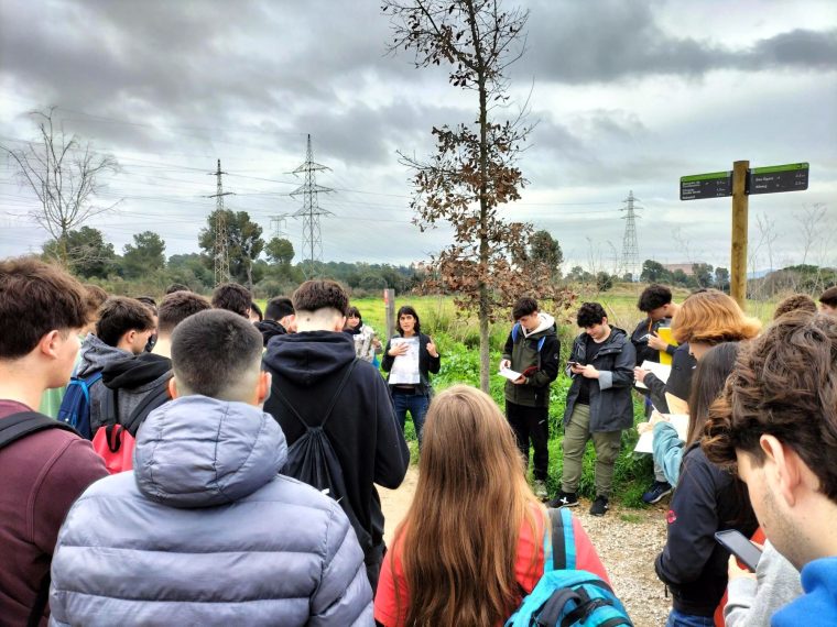
The field activities related to this case study began on March 11, with an informative session led by Marga Rodríguez, head of the Natural Resources and Sustainability Service of the Terrassa City Council. Afterward, a guided tour was held along the Torrebonica and Can Canya route. On March 18, a second field trip took place in the Les Martines area, where students deepened their analysis of the territory and gathered information for the diagnosis and management proposals. Both field trips involved the participation of the Department faculty Antoni Durà, Àngels Pérez and Mar Esteve, and the technician Carol Salmerón Marí, Environmental and Sustainability Technician at the City Council of Terrassa.
The work will continue until June 17, when the final results will be presented to the faculty and involved stakeholders.